https://sa.kapamilya.com/absnews/abscbnnews/media/2023/news/10/03/jenny-10032023.gif
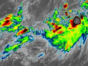
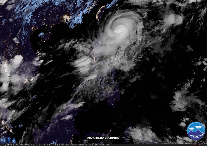
Typhoon Jenny remains a potent weather system, but the latest updates from the Philippine Atmospheric, Geophysical and Astronomical Services Administration (PAGASA) indicate that it is not on track to make landfall in the Philippines. As of 4 a.m., the typhoon’s center was located approximately 350 km east of Basco, Batanes. Jenny boasts sustained winds of 165 kph and gusts of 205 kph, moving west-northwest at 15 kph.
“This is a powerful typhoon,” emphasized PAGASA weather forecaster Lorie Dela Cruz during a TeleRadyo Serbisyo interview. PAGASA predicts that Jenny is likely at or near its peak intensity, with a weakening trend expected to commence due to increased dry air entrainment and vertical wind shear. The interaction with the rugged terrain of southern Taiwan during its passage is anticipated to further weaken the tropical cyclone. Upon crossing the Taiwan Strait, additional cool dry air from the north will contribute to Jenny’s continued weakening, according to PAGASA.
Tropical Cyclone Wind Signal No. 2 is raised over Batanes, while TCWS No. 1 is in effect for various areas, including Cagayan, Babuyan Islands, northern and eastern portions of Isabela, Apayao, northeastern portion of Abra, and the northern portion of Kalinga.
Batanes and Babuyan Islands are expected to experience 50-100 mm of forecast accumulated rainfall today. Furthermore, Jenny will enhance the southwest monsoon, bringing gusty conditions over specific areas for the next three days. These areas include Aurora, Bataan, Bulacan, Metro Manila, CALABARZON, Bicol Region, and most of MIMAROPA and Western Visayas today, and tomorrow will see impacts in Bataan, the southern portion of Aurora, Metro Manila, CALABARZON, Romblon, and most of Bicol Region.